Event
Architecture + Cities Research Forum: “Mapping the relationship between flooding and urban form in Jakarta” by David Mathewson
8 February 2026
Online
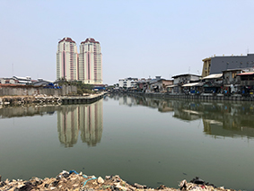
This seminar reviewed the relationship between flooding and Jakarta’s urban form, as shaped by planning policy and flood infrastructure. Historical institutionalism was employed, together with mapping of urban morphological change over time, to understand the nature of planning decisions in response to inundations, utilising satellite imagery, GIS-based open-source data, and historic map analysis. The seminar told the story of a city physically and spatially shaped by flooding over more than four centuries up to the present day. It also discussed the future of flood resilience in the city through a series of workshops that were held with local water experts.
25/03/2026